
Basic Course on Turbulence and Turbulent Flow Modeling 3: 3.1 Weather calculation and fluid simulation
Relationship between turbulent flow and the weather forecast
3.1 Weather calculation and fluid simulation
Fluid simulation is used to forecast the weather that is seen on TV and in the newspaper every day. While weather observation data is important for the weather forecast, fluid simulation also plays a large role. Today, fluid simulation is an essential tool in meteorology to simulate meteorological phenomena, from daily short term weather forecasts to long term climate change.
Using fluid simulation for weather forecasting started back when computers had very limited capabilities compared to what they have today. The “Human computer plan” used hundreds of researchers in an attempt to perform large computations with limited computer power. With this approach, each researcher acted like a calculation cell and would execute one part of the calculation under the direction of a leader. This method was not successful and was curtailed. However; predicting the weather using computational methods continued and showed more and more potential as hardware capabilities improved.
3.2 LES comes over!
Climate calculation is a large earth-scale simulation. Even a super-computer cannot calculate every wind flow across the entire earth. At one time, attempts were made to focus only on large wind behavior, e.g., wind behavior caused by a typhoon or westerlies. However, the mesh needed to simulate the behavior of a typhoon is not sufficient to calculate the surrounding wind behavior induced by the typhoon. A typhoon is not a solid body. It grows stronger by engaging the air in the surroundings (creating wind) and causing it to move in a forward path. Hence, detailed wind behavior (much smaller than just the size of typhoon) must be considered in these calculations. This is one example of the challenges encountered when using fluid simulation to forecast the weather.
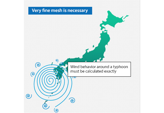
Figure 3.1: Calculation without modeling
One of the methods used to overcome the difficulties is large eddy simulation (LES) proposed in 1963 by Joseph Smagorinsky (an American meteorologist). In LES, mesh-representable wind behavior is directly calculated. In addition, the effect of small wind behavior which cannot be captured by the mesh is modeled as shown in Figure 3.2. With this approach, fluid simulation can predict the path of a typhoon using a coarse mesh as shown in Figure 3.
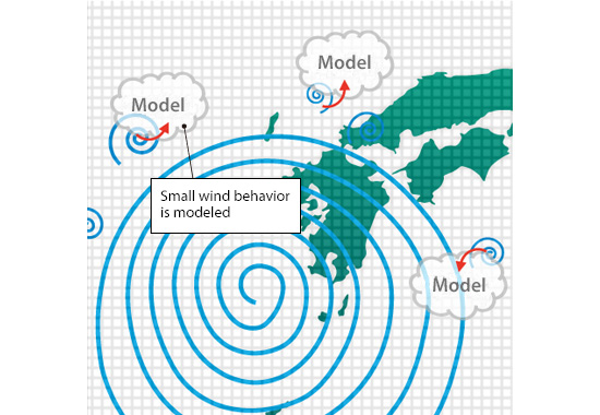
Figure 3.2: Modeling in LES
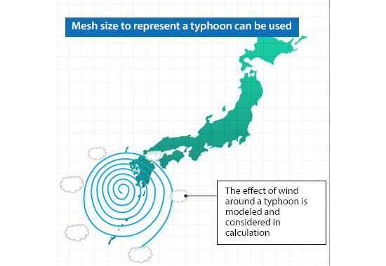
Figure 3.3: Calculation with LES
A typhoon develops from rising air current in a tropical zone. This can be simulated by winds blowing at different velocities as shown in Figure 3.4.
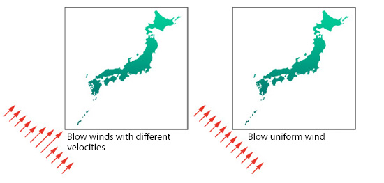
Figure 4: Winds with different velocities
Figure 3.5 shows the calculation results with a relative velocity obtained by subtracting the average velocity in the oblique direction from the calculated velocity. The average velocity is the rotational velocity of the earth. Typhoon occurs from winds blowing on the rotating earth.
Figure 5: Analysis result of wind behavior like typhoon
With improved computers, LES is now used to calculate various phenomena as a feasible means to analyze turbulence. I hope this article gives you an insight into its foundation, which was derived from everyday weather forecast.

About the Author
Takao Itami | Born in July 1973, Kanagawa, Japan
The author had conducted researches on numerical analyses of turbulence in college. After working as a design engineer for a railway rolling stock manufacturer, he took the doctor of engineering degree from Tokyo Institute of Technology (Graduate School of Science and Engineering) through researching compressible turbulent flow and Large-Eddy Simulation. He works as a consulting engineer at Software Cradle solving various customer problems with his extensive experience.